Create an Analysis Area Based on an Address
Define Your Location Data Type
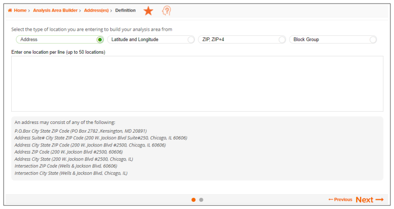
On the Address(es)>Definition screen, select the type of location data that you want to use to create your analysis area(s), type the location data in the required format, and then click Next.

To Learn More:
Analysis Areas, Using Addresses
- On the Address(es)>Definition screen, select the type of location data that you want to use to create your analysis area. The options are Address, Longitude and Latitude, ZIP/ZIP+4, and Block Group.
- In the box below, type your location data in the appropriate format. The required format for each location data type are:
- Address
- P.O. Box City, State ZIP Code
- Number Street Suite #, City, State ZIP Code
- Number and Street, City, State ZIP Code
- Number and Street, ZIP Code
- Number and Street, City, State
- Latitude and Longitude
- DD.DDDDDD, DD.DDDDDD
- DD:MM.MM, DD:MM.MM
- DD:MM:SS, DD:MM:SS
- Locations usually have a positive latitude and a negative longitude
- ZIP, ZIP+4
- ZIP Codes: 5 digits
- ZIP+4: 9 digits
- Must include leading zeros
- Block Group: 12 digits, must include leading zeros
-
Verify your entries and then click Next. The Analysis Area Builder>Address(es)>Definition>Method screen appears.