Change Map View
The Interactive Map comes with several Zoom tools that allow you to change your map view.
Zoom In (Enlarge)
To enlarge the map display in increments, click the Zoom In icon ( ). Continue to click the icon until you get your desired display size.
Zoom Out (Reduce)
To reduce the map display in increments, click the Zoom Out icon ( ). Continue to click the icon until you get your desired display size.
Custom Zoom
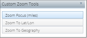
The Custom Zoom tools allow you to navigate around the Interactive Map using a variety of functions designed to help you locate and specify customized map views. The available functions or tools are:
-
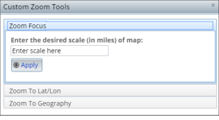
Zoom Focus: Allows you to designate the exact scale of your map window. The map will zoom in/out to achieve the desired horizontal extent. For example, a Zoom Focus scale of 50 miles means that the map window will represent 50 miles across.
-
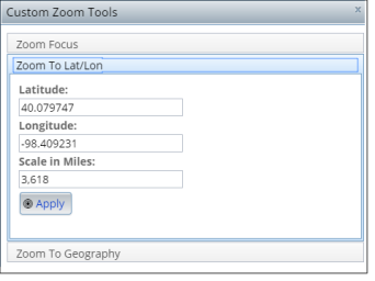
Zoom To Lat/Lon: Allows you to locate the latitude and longitude coordinates of the map view's centroid, and the associated map scale (refer to the Zoom Focus example). For example, a lat/long of 38.5885, -90.235 means that the center of your map is positioned near St. Louis, Missouri.
-
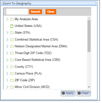
Zoom To Geography: Allows you to search/browse the geography tree to locate standard geographies or previously-created analysis areas. The search term is used as a keyword/keycode. For example, searching "92121" returns geographies of all levels and analysis areas that include "92121" as a part of the name or Federal Information Processing Standards (FIPS) code. Alternatively, searching "Washington" returns geographies of all levels and analysis areas that include "Washington" as a part of the geographic name.
To customize your map display size, click the Custom Zoom icon ( ). When the Custom Zoom Tools pop-up window appears, select how you want to customize your display by specifying the scale, latitude/longitude coordinates, or geography of your zoom focus.

To Learn More:
- Click the Custom Zoom icon (
 ). The Custom Zoom Tools pop-up window appears.
 - To set your desired scale (in miles) of map, click Zoom Focus, type your desired scale or range (in miles) in the text box below Enter the desired scale (in miles) of map, and then click Apply. Your map display adjusts based on your specified scale.

To set the latitude/longitude of your zoom focus, click Zoom To Lat/Lon, type your desired latitude and longitude coordinates in the appropriate text boxes, type your desired scale in miles in the Scale in Miles text box, and then click Apply. The map zooms to the specified coordinates and the display adjusts according to your specified scale.
To set a geography as your zoom focus, click Zoom To Geography, navigate to and select your desired geography, and then click Apply. You may also use the Search button to locate your desired geography. The map zooms to the location or area that you specified.
- To close the pop-up window, click either the x mark located in the upper-right corner of the box or the Custom Zoom icon (
 ) on the main toolbar.
Zoom to Box
To zoom to a rectangular area on the map, click the Zoom to Box icon ( )and then click to draw a rectangular box on the map. The map zooms to the area within the box.
NOTE: You may need to pan or move the map display to find your focus area. To pan, click the map and drag the cursor to the direction you want to move the map and locate your focus area.